 2022-2027 Bond Project: West College Link (St. Mary’s to Memorial High School to Zarzamora Creek)
2022-2027 Bond Project: West College Link (St. Mary’s to Memorial High School to Zarzamora Creek)
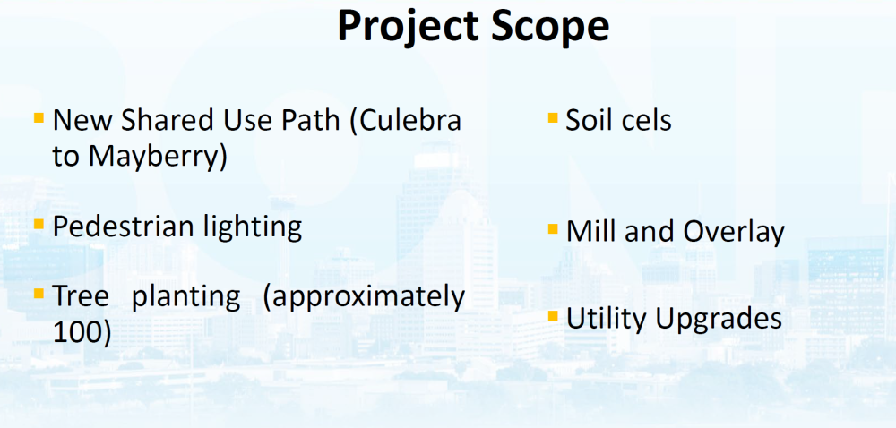
This Project includes a proposed shared use path 12' wide along the east side of Memorial Street (Culebra to Mayberry) to connect to existing trails at Zarzamora Creek, and to St. Mary’s University.
Project Type: Streets, Sidewalks & Parks
Phase: Construction
Project Budget: $4.7 Million
Project Contact: Tania Mendoza - (210) 207-6905
Estimated Construction Timeline: Spring 2025-Summer 2026
Estimated Timeline Construction Seasons are identified as: Winter (January, February, March), Spring (April, May, June), Summer (July, August, September), and Fall (October, November, December.)
Associated Projects:
Project Limits:

What you need to know
- CPS Energy in coordination with E-Z Bel Construction will begin work as early as Thursday, February 12, 2026 thru March, 2026 for the construction of a utility pole and overhead electrical lines at Memorial St. & Pickford Ave. intersection.
- The intersection will have full access to traffic.
- Detour routes will be provided for temporary lane closures as needed.
- See map provided.

Roadway detour map (as needed)
Overall Project Information
- This Project includes a proposed shared use path 12' wide along the east side of Memorial Street (Culebra to Mayberry) to connect to existing trails at Zarzamora Creek, and to St. Mary’s University.
- Current work includes roadway improvements, curbs and sidewalks, tree installation, irrigation and pedestrian lighting.

Memorial Street sidewalk work - East side

Memorial Street sidewalk work - South view

Memorial Street sidewalk work - South view

Memorial Street sidewalk work - North view
NOTE TO BUSINESS OWNERS:
If your business is currently or expected to experience construction in your area please visit the City of San Antonio's Construction Toolkit. This guide helps business owners understand and prepare for City-initiated construction projects.
Learn more about City projects in your neighborhood and across San Antonio. The City of San Antonio’s digital dashboards encompass a wide range of projects, including streets, drainage, parks, and facilities.