 City Redistricting: Be Part of the Process
City Redistricting: Be Part of the Process
Based on the results of the 2020 Census, a committee has been formed to address redistricting in the City of San Antonio. Members of the community have been appointed by the Mayor or their Councilmember to form a redistricting advisory committee. This committee will be responsible for redrawing district boundaries after the 2020 Census revealed a change in population.
Same City, New District Lines
Based on the responses of the 2020 Census, each district’s geographical boundaries were redrawn due to the growth of population in San Antonio. San Antonio residents were educated on the process, attended 15 map drawing meetings, and submitted more than 300 public comments. The Committee was able to reflect the interests of the community to determine new City Council district boundaries with balanced representation across the districts, in compliance with the U.S. Constitution and City Charter.
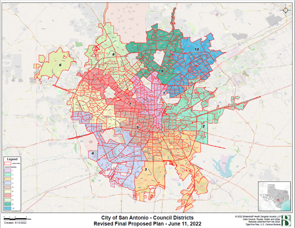
Use an interactive map to find your district based on your address. Find your district.
Did you know that redistricting is tied to the Census?
Learn why getting a complete count in the 2020 Census was important to you and your community.
This video will give you a deeper understanding of what redistricting is, the process and how it complies with public law.
This is hidden text that lets us know when google translate runs.