 Fort Sam Houston Area Regional Center Plan: Survey #3
Fort Sam Houston Area Regional Center Plan: Survey #3
The City of San Antonio Planning Department is gathering input to improve the draft recommendations that have been developed related to Land Use, Housing, and Economic Development for the Fort Sam Houston Area Regional Center Plan. We are also gathering community input related to Focus Areas, Amenities and Public Spaces, and Mobility to determine what should be evaluated and refined as we continue with the planning process. Please submit your feedback by completing the survey by Thursday, August 3, 2023.
For any questions, please email Heather Yost at: heather.yost@sanantonio.gov
Para ver y participar en la versión en español de esta encuesta, visite: saspeakup.com/fortsamhouston-survey3-span
Currently in Stage 1: Community Engagement
Community Engagement
This survey is will be open until Thursday, August 3, 2023. Thank you for taking the time to make sure your voice is heard for your city!
Project Background
The Fort Sam Houston Area Regional Center Plan ("Plan") will help guide development and investments in the area over the next 10 to 15 years. Specifically, the Plan will address the following topics:
- Land Use
- Housing
- Economic Development
- Mobility
- Amenities and Public Spaces
In Community Survey #3, the City of San Antonio Planning Department is requesting input on draft Land Use, Housing, and Economic Development recommendations, in addition to requesting input that will be used to develop similar draft recommendations for Mobility, and Amenities & Public Spaces needs specifically for the plan area. All recommendations are meant to build on the Plan’s draft Vision and Goals, which were developed using community input from past surveys and community meetings.
Draft Vision:
The Fort Sam Houston Area Regional Center is a high-quality place to live, work, learn, and play with safe and distinct neighborhoods connected to and well-integrated with the military base, AT&T Center, and vibrant employment areas. This mosaic of San Antonio’s past, present, and future is woven together with a robust trail and greenway system providing local and regional transportation and recreation opportunities; a well-connected and well-maintained network of shaded roadways and streets; and walkable, bikeable, and transit-friendly mixed-use districts that serve local residents during non-event times and visitors during events.
Draft Goals:
Promote quality development that is compatible with existing neighborhoods and includes additional housing options for military and non-military families and households.
Improve existing connections and create new connections and crossings that are truly multimodal, aesthetically pleasing, and provide stormwater benefits.
Provide more greenways, trails, and recreational amenities throughout the Regional Center and connect to nearby areas.
Strategically locate additional medium- and higher-density mixed-use development to create districts that double as locally serving hubs of small business and visitor entertainment destinations.
Facilitate overall development patterns that include local employment and entertainment opportunities.
Improve comfort, safety, and aesthetics throughout the Regional Center with trees, other urban greening, and integration of sustainable infrastructure.
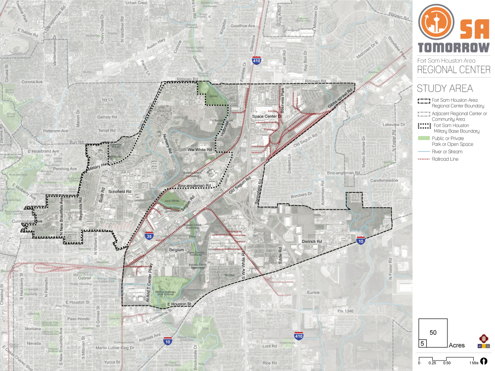
The boundaries of the Plan area are shown on the Study Area map. Please reference this map when answering questions.
Draft Recommendations: Land Use, Housing, and Economic Development
The draft recommendations for Land Use, Housing, and Economic Development for the Fort Sam Houston Area Regional Center were created based on public input during public meetings and surveys. Please review the draft recommendations for Land Use, Housing, and Economic Development, and use the slider to indicate the extent to which you agree or disagree with each. If you have ideas for improvements or general comments relating to the draft recommendations, use the space provided for comments.
Use the slider to rate how much you agree or disagree with each recommendation.
DRAFT Land Use Recommendation #1
Encourage continued infill development and redevelopment activity near the AT&T Center and Freeman Coliseum.
DRAFT Land Use Recommendation #2
Stimulate revitalization and/or redevelopment along mixed-use corridors and commercially designated areas to increase community-serving options for those who live and work in the plan area.
DRAFT Land Use Recommendation #3
Ensure continued productivity of industrial areas, while minimizing negative impacts on nearby neighborhoods
DRAFT Land Use Recommendation #4
Protect the quality of life and stability of the existing residential neighborhoods within the Regional Center.
DRAFT Housing Recommendation #1
Encourage higher density infill housing development in areas that are compatible for residential uses.
DRAFT Housing Recommendation #2
Expand the diversity of housing options to include different housing densities, tenure, and price.
DRAFT Housing Recommendation #3
Mitigate potential negative impacts of new investment in the area on existing residents through proactive use of tools that can address involuntary displacement.
DRAFT Economic Development Recommendation #1
Create a mixed-use entertainment area adjacent to the AT&T Center and Freeman Coliseum.
DRAFT Economic Development Recommendation #2
Develop a strategy to leverage spin-off economic activity from the Fort Sam Houston military base and Brooks Army Medical Center.
DRAFT Economic Development Recommendation #3
Identify strategies to utilize existing industrial space in the Regional Center to support new and small business creation and expansion.
Comments?
Leave any comments or ideas you have for the draft recommendations.
Mobility, Focus Areas, and Amenities & Public Spaces
This section of the survey will help us gather input from the community to help staff develop draft recommendations for the Mobility and Amenities & Public Space sections of the Plan.
Mobility:
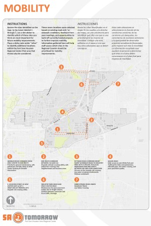
Review the sites identified here and rank them in order from 1 through 7, with 1 being the top priority for the most important location for future mobility improvements.
Mobility
Use the comment box to suggest additional sites that need mobility-related improvements, and to describe what kinds of mobility improvements you would like to see in your priority sites or within the Plan area.
Focus Areas, and Amenities & Public Spaces
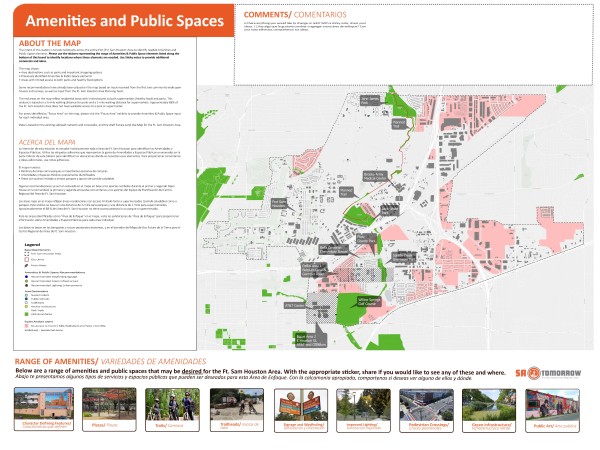
Using the interactive map, please select the appropriate pin and place it (drag and drop) on the map where you would like to see that type of amenity or public space feature. The map depicts the boundary for the entire Fort Sam Houston Area Regional Center.
You may zoom into the map and place pins anywhere within the Plan Area and share your thoughts by typing in the comments section.
Optional Questions
The next set of optional questions will help us improve our outreach efforts across the City. The information you share helps us better understand how your lived experiences contribute to your experience and perceptions in this survey. Your responses will remain anonymous.